The Russian River Watershed Association (RRWA) is a coalition of eleven cities, counties and special districts in the Russian River Watershed that came together in 2004 to coordinate regional programs for clean water, habitat restoration and watershed enhancement.
West Yost is assisting RRWA in meeting the primary objectives of their Prop 1 grant to develop a regional Stormwater Resource Plan (SWRP) for the entire Russian River Watershed. The SWRP will identify projects that maintain and restore pre-development hydrology and improve water quality by limiting pollutants carried in stormwater runoff from entering local waterways and encourage the use of green infrastructure practices to manage stormwater runoff.
Project includes:
Collaborating with the community to develop, implement, and complete a watershed-wide SWRP including all mandated plan elements and a prioritized list of implementation projects;
Utilizing implementation projects to demonstrate and educate the local and regional community on the importance of stormwater management and the benefits of LID practices; and
Reducing stormwater volume and pollutant loading in stormwater runoff.
West Yost provides a complete range of stormwater engineering services on projects ranging from drainage studies for small individual sites through regional solutions for large watersheds. Our stormwater planning and design engineers have a strong history of delivering projects that demonstrate value through innovative thinking, and significantly reduced capital costs of solutions and alternatives. Our expertise includes technical depth in storm drainage master planning, facility design; preparation of environmental impact reports addressing storm drainage, water quality, wetlands, water rights, and soil erosion; and hydrologic and hydraulic drainage system modeling.
To see descriptions of Construction Management on similar projects please Click Here
For information on our Funding and Grants Click Here
The Russian River Watershed Association (RRWA) is a coalition of eleven cities, counties and special districts in the Russian River Watershed that came together in 2004 to coordinate regional programs for clean water, habitat restoration and watershed enhancement.
West Yost routinely conducts accurate hydrologic/hydraulic evaluations. This includes using dynamic 2-dimensional (2-D) surface flow modeling to more accurately predict results and to graphically demonstrate solutions. Recent projects include the Alamo Creek 2-D Flood Study for the City of Vacaville, and 2-D modeling for a 4,000 acre alluvial fan flooding analysis in the Mojave Desert for the Ivanpah Solar Facility project.
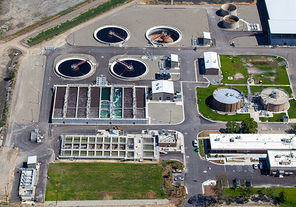
West Yost provided planning, analysis, environmental review, permitting, design, and construction management services for the Dry Creek Wastewater Treatment Plant Pond Levee Relocation. This project included the hydrologic and hydraulic evaluations of setting the pond levees 100 feet back from the Dry Creek bank in order to provide 100-year protection of the wastewater storage ponds while enhancing the flow-carrying capacity of Dry Creek in an environmentally sensitive manner.
The Russian River Watershed Association (RRWA) is a coalition of eleven cities, counties and special districts in the Russian River Watershed that came together in 2004 to coordinate regional programs for clean water, habitat restoration and watershed enhancement.
The goal of this study was to develop a document that could serve as the basis for obtaining LEED credit for New Construction (NC) and for Commercial Interiors (CI). Land use conditions were evaluated for the years 2011 (existing conditions), 2015 (short term future land use), and 2030 (and long term future land use). The impervious coverage in the Central Campus was determined for each time period, and the existing conditions impervious coverage was field verified and revised.
West Yost prepared a 2-dimensional storm drainage model for a proposed 400 MW solar power project covering 4,000 acres in the Ivanpah Valley in the Mojave Desert in California. The project is situated on an alluvial fan located at the base of the Clark Mountain Range. Flood flows from the mountains are initially confined in incised channels, but once arriving on the alluvial fan, the flood flows are less confined and can take random paths across the fan.
Using Flo-2D modeling software, West Yost developed a 2-dimensional hydraulic model to route Alamo Creek overflows through a residential neighborhoods for several miles and back into Alamo Creek. Staff also prepared a FEMA LOMR application for a portion of the floodplain.
The goal of this study was to develop a document that could serve as the basis for obtaining LEED credit for New Construction (NC) and for Commercial Interiors (CI). Land use conditions were evaluated for the years 2011 (existing conditions), 2015 (short term future land use), and 2030 (and long term future land use). The impervious coverage in the Central Campus was determined for each time period, and the existing conditions impervious coverage was field verified and revised.
Thorough assessment of pump station condition is essential to understanding if a facility should be rehabilitated or replaced. West Yost conducted condition assessments of the 22 storm drain pump stations and the 12 sanitary lift stations that UC Davis owns and operates. This project required a phased approach focusing first on the pump stations of highest concern, to meet tight initial deadlines for funding.
West Yost under contract to an environmental services firm, provided engineering design and construction period services for converting 217 acres of rice farmland into a wetlands and endangered giant garter snake habitat. The wetland will rely on two water sources: agricultural delivery and an onsite supplemental groundwater well.
West Yost staff members routinely provide stormwater engineering services in support of transportation projects. These services include: hydrologic and hydraulic analyses to define drainage and stormwater quality treatment facilities; design of pump stations to evacuate storm runoff; and hydraulic and scour potential for bridges and overcrossings.