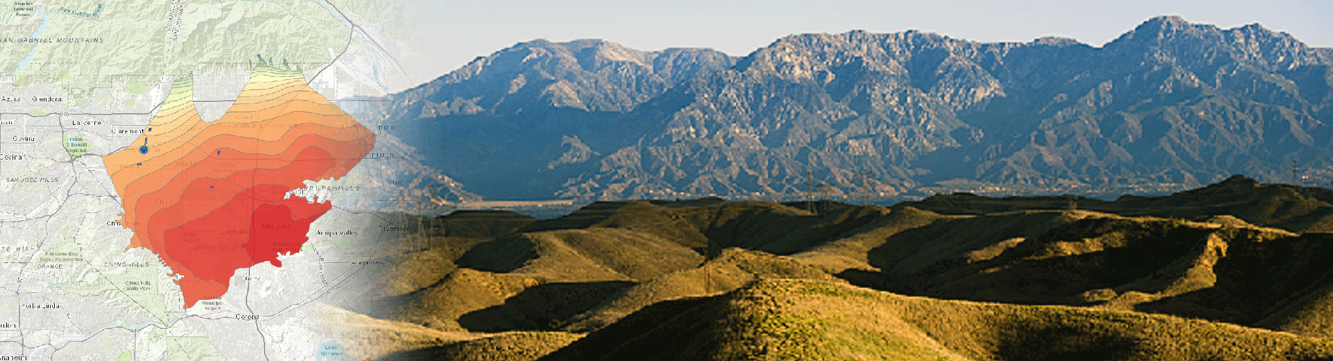
The Chino Basin is a large alluvial groundwater basin in Southern California with storage exceeding five million acre-feet. Groundwater in the Chino Basin generally flows from the forebay regions in the north towards the Prado Flood-Control Basin in the south (“Prado Basin”). Depth to groundwater is relatively shallow in the Prado Basin area, which allows for groundwater/surface-water interaction.
The Chino Basin Watermaster, the agency responsible for groundwater basin management, implements aggressive groundwater-supply programs that include controlled overdraft and the possibility of causing groundwater-level declines in the basin. The EIR for the groundwater-supply program identified the lowering of groundwater levels as a potentially adverse impact on the Prado Basin’s riparian vegetation that consumptively uses shallow groundwater.
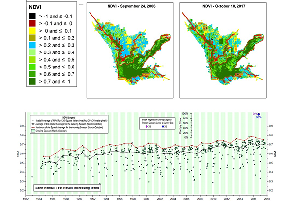
Our team developed the monitoring and reporting program and has recently begun its implementation. The first step was to design, drill, construct, and develop 16 monitoring wells located near the riparian habitat to track changes in groundwater levels within the shallow or perched aquifer systems. The monitoring program also includes characterization of the extent and quality of the riparian habitat over time, which required the acquisition and analysis of remote-sensing data from the Landsat program, high-resolution aerial photography, and field vegetation surveys. The program also involves monitoring all factors that could potentially impact the habitat (not only changes in groundwater levels), including surface-water discharge, precipitation, temperature, wildfire, and pests, among others. Lastly, the program includes groundwater-flow model projections of future drawdown to identify areas of prospective impacts on riparian habitat. In 2017, the Watermaster published the first annual report, which identified no current or future adverse effects on the riparian habitat and recommended certain refinements to the monitoring program.
Team Spotlight

Veva Weamer
Supervising Scientist

Veva Weamer
Supervising Scientist
“I get to work on a variety of projects and each one is unique, different, and interesting, which I find exciting! I work in different regions and each has unique circumstances, challenges, and solutions to supply water to their communities. It is work that most people don’t know about or think about, but is very important because everyone uses water. My work is in the background helping agencies supply water their communities. It is very interesting to me!
I am proud of a project I am working on now to develop a Groundwater Sustainability Plan for the Spadra Basin. It will allow these agencies to continue to use a local source of water for the long-term future. Our plan will ensure that the Spadra Basin is a sustainable source of water supply and optimize the use of the basin.”

Lucy Hedley
Scientist I

Lucy Hedley
Scientist I
“I have learned so much from everyone in the Groundwater Business sector and have continually been challenged and rewarded by all the different types of projects that I have worked on. The innovative approach that the team takes makes projects not only interesting and exciting to work on, but results in quality work that is appreciated by all of our clients.
I am very proud of a recent project we did in which we used various methods and analyses to assess the presence, distribution, and the potential sources of PFAS in a watershed. This was the first PFAS watershed investigation we had done and due to the rapidly changing developments relating to PFAS, we had to continue to adjust our work throughout the project to stay up-to-date. Shortly after we finished, another client was so impressed with the work that they solicited us to perform a similar investigation for them.”

Sodavy Ou
Associate Scientist I

Sodavy Ou
Associate Scientist I
“What excites me most about my work is having access to diverse water-resources experts (from regulatory compliance to operations technology and cybersecurity and everything in between) who work at West Yost. This comprehensive set of knowledge on municipal water services has improved my ability to efficiently support our clients.
I am most proud of our project to support the Elsinore Valley Municipal Water District (MWD) and Eastern MWD with the development and implementation of a salt and nutrient management plan (SNMP) for the Upper Temescal Valley area. The SNMP was adopted by the Santa Ana Regional Water Quality Control Board in 2020 and established a comprehensive monitoring and reporting program and helped initiated the development of a mitigation framework to protect the water quality of the Upper Temescal Valley groundwater management zone.”